All-in-one flight planning for drone pilots
Smarter planning that connects your missions to the information that matters most.
4.8
2,000+ Reviews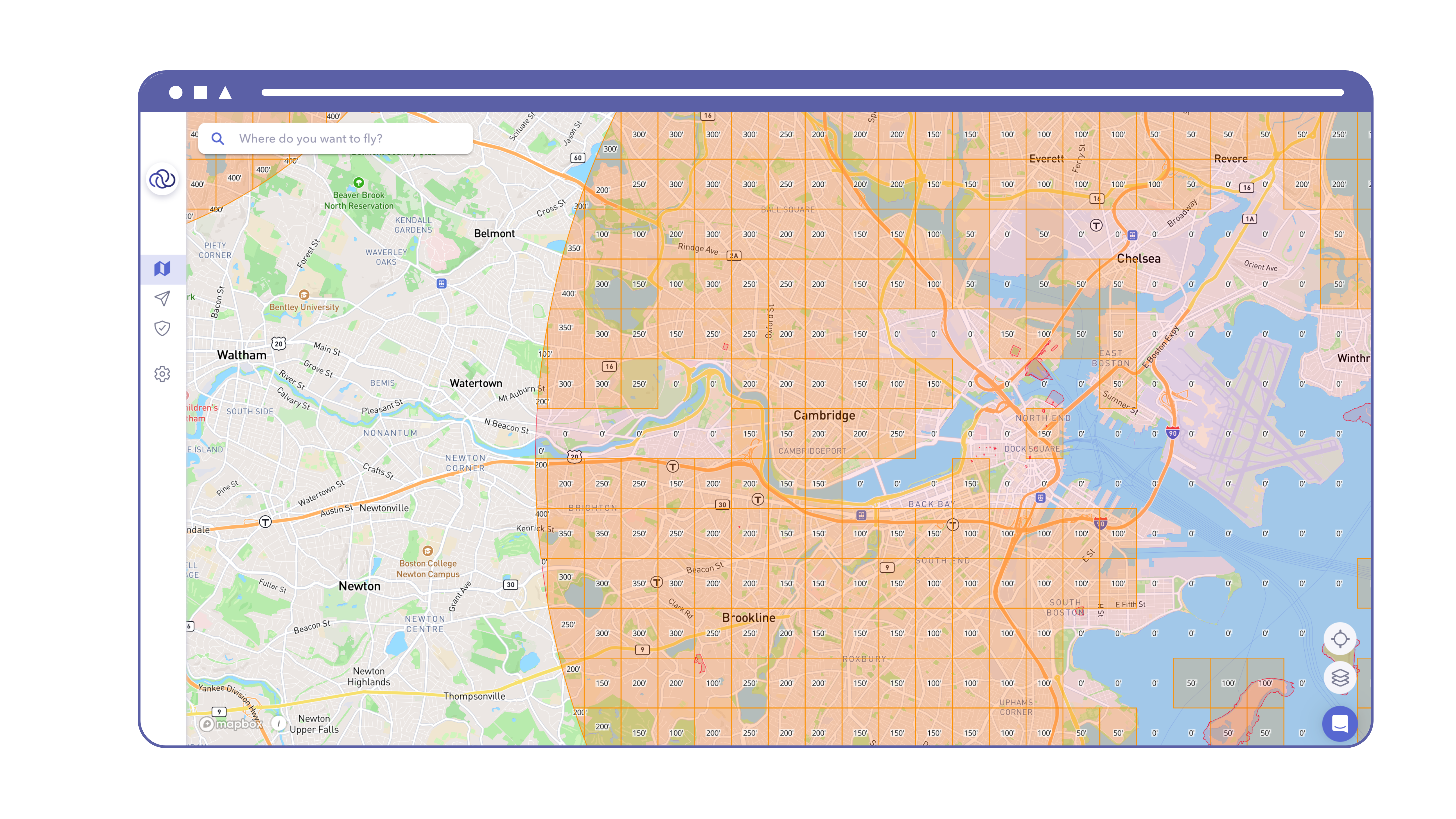
AutoPylot is an FAA-approved provider of B4UFLY and LAANC services.

Why AutoPylot
Have Everything You Need In One Place
AutoPylot enables drone pilots to prepare for flights more efficiently and safely with features such as airspace, weather, and flight management.
Check B4UFLY
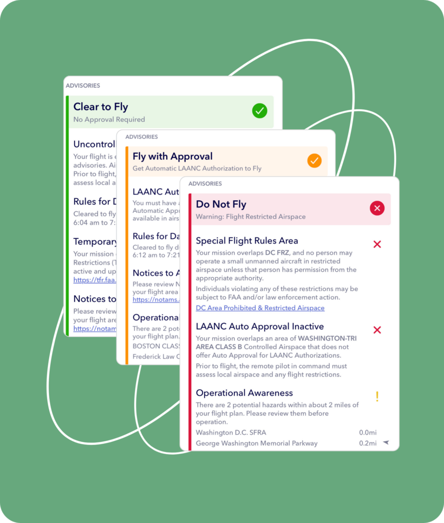
B4UFLY is a collaboration between the Federal Aviation Administration (FAA) and private industry, like AutoPylot, to safely integrate recreational drones into the national airspace system. AutoPylot helps provides recreational flyers with safety information and airspace awareness prior to flight through our web and mobile applications
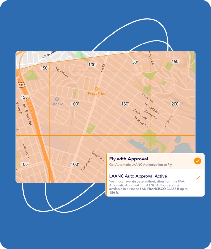
Request LAANC
LAANC, is a collaboration between the Federal Aviation Administration (FAA) and private companies like AutoPylot to safely integrate small drones into the national airspace. LAANC is available to both Recreational flyers and Commercial (Part-107) drone pilots through the AutoPylot platform.
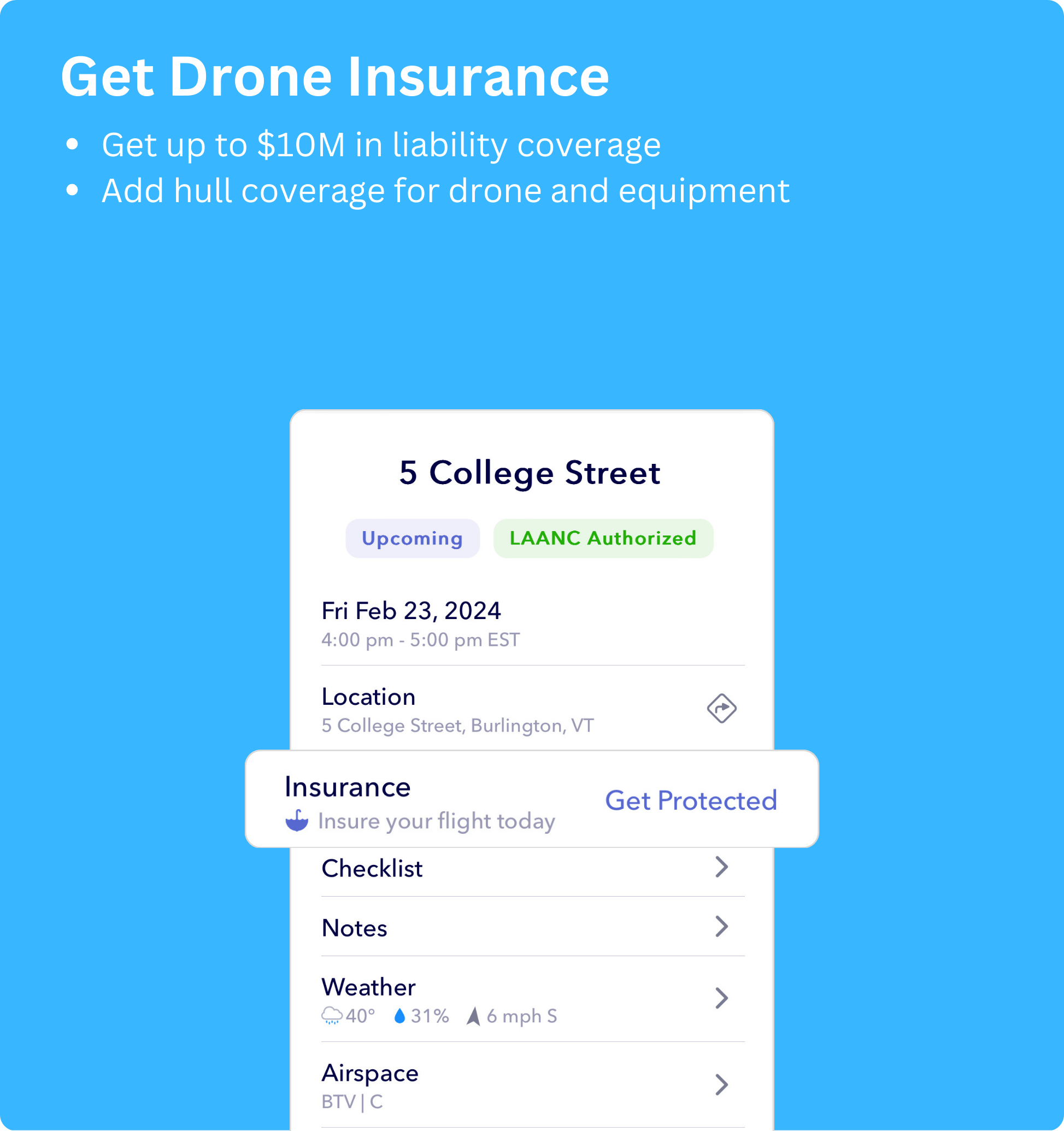
Get Drone Insurance
Drone insurance offers a safety net for drone owners and operators, providing coverage for accidents, damages, and liabilities, including hull protection for the drone itself. Our comprehensive coverage lets you fly confidently, knowing that your investment is safeguarded against unexpected events.
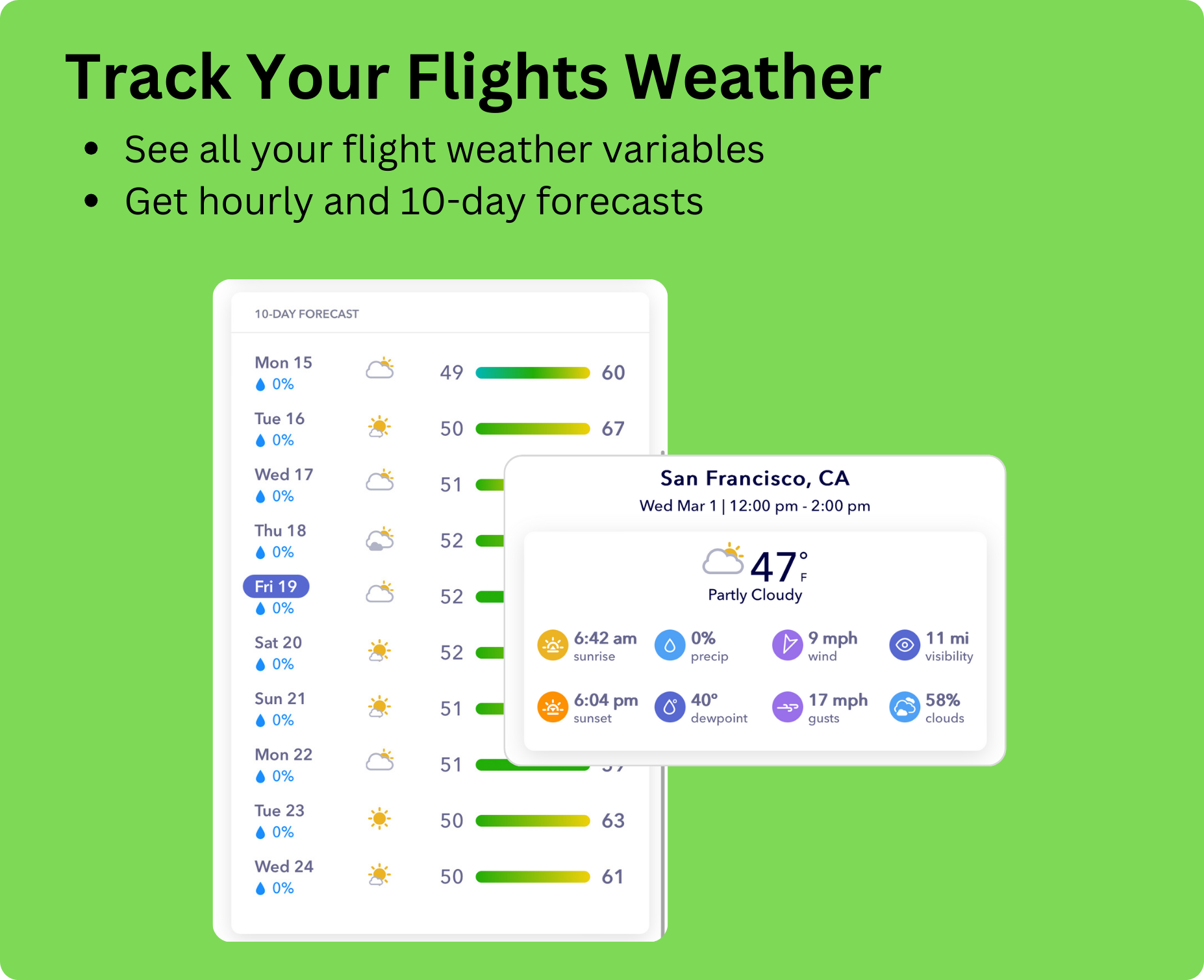
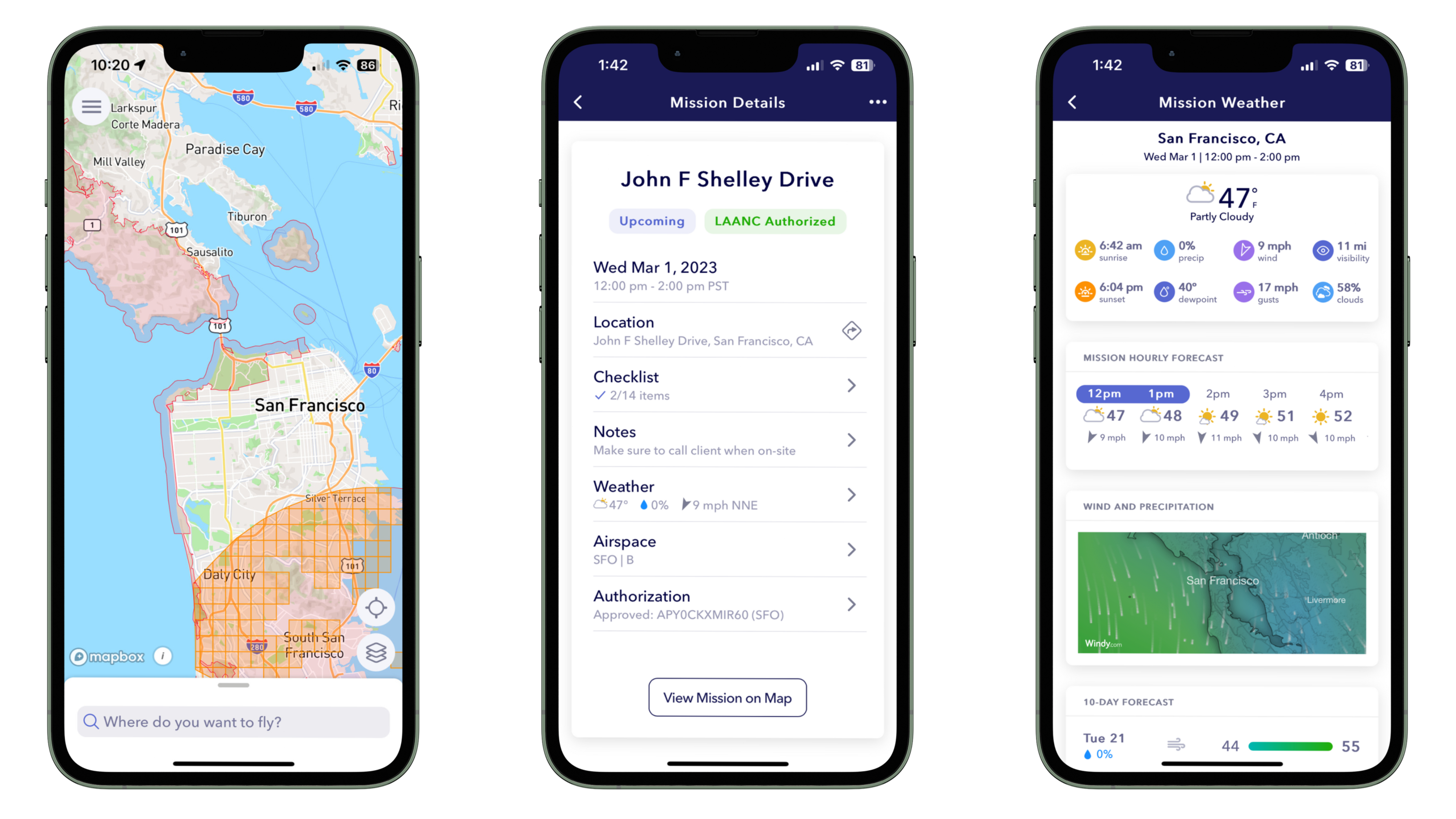
Track The Weather
Explore real-time weather insights tailored for drone pilots. AutoPylot offers in-depth weather tracking with hourly and 10-day forecasts, wind maps, and conditions analysis, empowering you to confidently plan safe and successful flights.
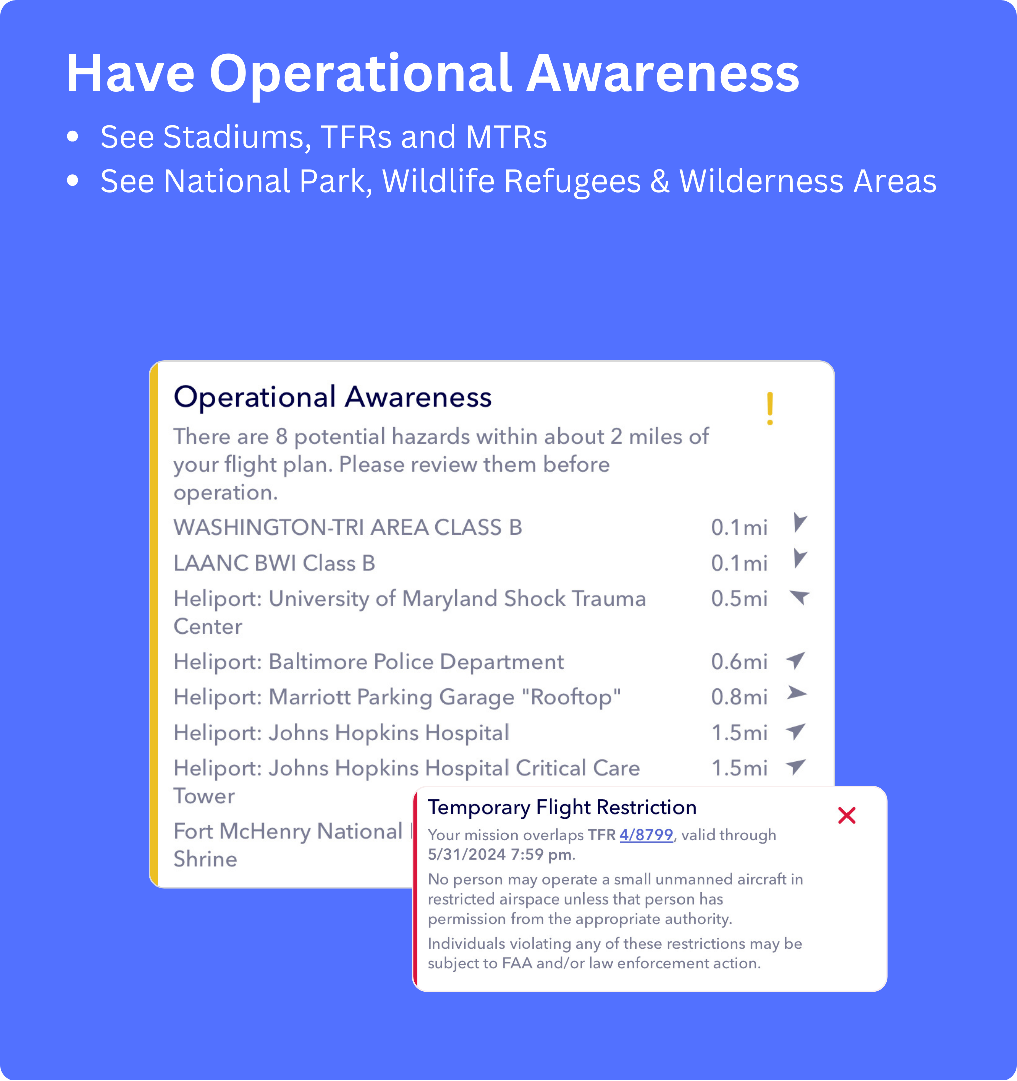
Operational Awareness
From stadiums to Temporary Flight Restrictions (TFRs), from military training routes (MTRs), to national parks, fly confidently and responsibly. Stay informed, explore safely, and contribute to a harmonious drone community with AutoPylot.
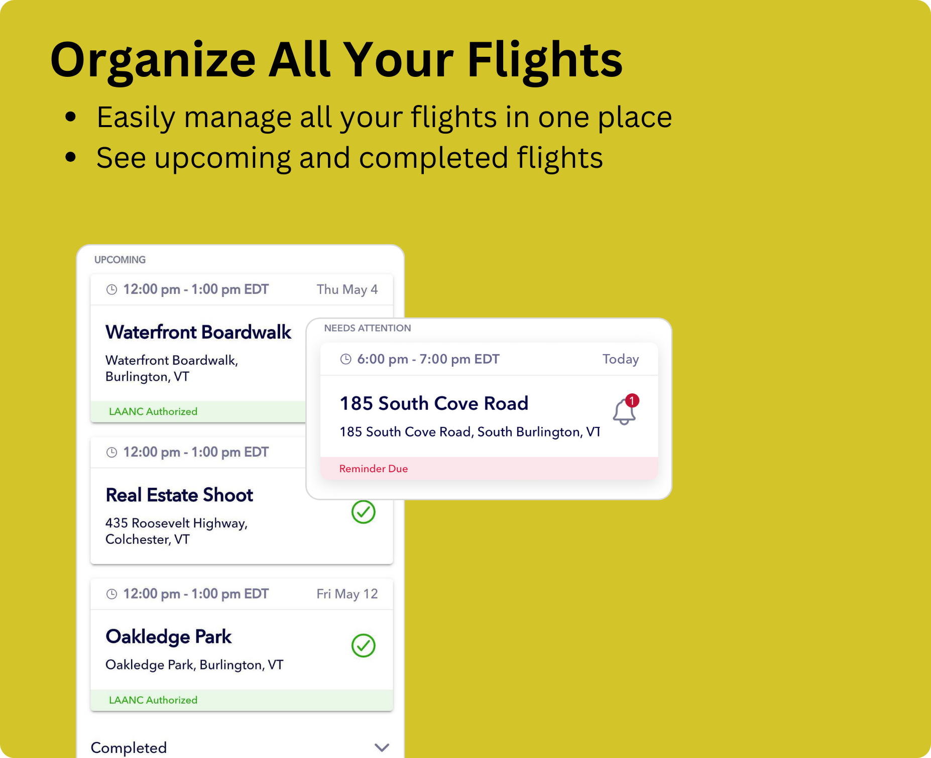
Manage Missions
Elevate your flight management experience with our all-in-one platform. Seamlessly plan, track, and organize your drone operations with advanced features tailored for efficiency and safety. With our intuitive flight management solution, you can take control of your flights like never before.
FAA-Approved
Stay Informed And Connected
With AutoPylot
AutoPylot is an FAA-approved provider of B4UFLY and LAANC Services
All the airspace information you need B4UFLY
B4UFLY is a collaboration between the FAA and private industry, like AutoPylot, to safely integrate recreational drones into the national airspace system.
Real Near-time access to controlled airspace with LAANC
LAANC, is a collaboration between the Federal Aviation Administration (FAA) and private companies like AutoPylot to safely integrate small drones into the national airspace.
Amazing Features
Powerful and Easy To Use Features
All the features you need to safely and efficiently plan your drone flights finally in one place
Mobile Apps
Plan Flights On The Go
Our Blog
Read Our Featured News and Articles


Get the answers.
Still curious about AutoPylot and LAANC? See FAQs below.
AutoPylot is an FAA-approved pre-flight planning software enabling drone pilots to legally know where it is safe to fly their drone(s).
AutoPylot offers both B4UFLY and LAANC to recreational, commercial, and government drone operators for free.
AutoPylot provides B4UFLY services and near real-time airspace authorizations to commercial pilots (Part-107) and recreational flyers. When requesting airspace access, pilots must enter their Remote Pilot Certificate number or TRUST Certificate Authentication Token number. This will be displayed in the menu header.
DJI Fly Zones are not official airspace data and are not the same as LAANC. The DJI system is not integrated with the FAA and is different than official national airspace maps. If you request to unlock a zone with DJI, this does not mean you are authorized to fly in that area, and you must request authorization through an FAA-approved supplier of LAANC or the FAA DroneZone. The FAA is the authoritative source on all airspace data.
AutoPylot is a pre-flight planning tool and does not connect to any drones to help operate them.
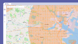
AutoPylot uses three primary colors to indicate a planned flight area’s operational status. A green radius and flight checklist indicate the mission is in Class G airspace, and the pilot does not need an airspace authorization to fly. A red radius, map area, and flight checklist indicate the proposed flight location overlaps a do not fly boundary. An orange radius and flight checklist indicate the proposed flight area is in LAANC-enabled airspace, and the pilot can request access at that location by continuing the mission creation process.
AutoPylot is integrated with National Park Service (NPS) data sources and advises flights in National Parks, Wilderness Areas and Wildlife Refuges.
To request a copy of your LAANC data or to request its destruction by deleting your account, please contact us at support@autopylot.io.